
GPS navigation systems are essential for today’s boaters, providing precise location tracking, route planning, and enhanced safety. Whether you’re an angler, sailor, or recreational boater, a reliable GPS can significantly improve your experience on the water. Here’s why every boater should consider a marine GPS system, along with the top features to look for.
What is a Marine GPS Navigation System?
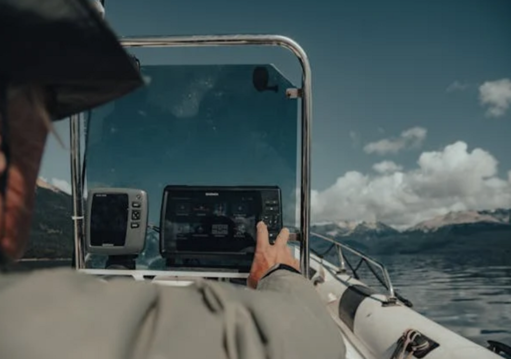
A marine GPS navigation system uses satellite signals to pinpoint your exact location on the water. Unlike regular GPS units, marine GPS systems are designed for boating environments, offering features like route mapping, tide tracking, and integration with sonar.
Key Benefits of a GPS Navigation System
- Enhanced Safety – Avoid hazards and track your path even in poor visibility or unfamiliar waters.
- Precision in Navigation – Reach your fishing spots and return to your starting point with ease, saving time and fuel.
- Route Planning and Marking – Plot your routes, mark locations of interest, and easily navigate back to favorite spots.
Important Features of a Marine GPS
- Integrated Maps and Charts – Look for models with preloaded charts or map expansion options for more detailed route planning.
- Combo Units with Fish Finders – Many GPS units integrate with fish finders, offering a complete navigation and fish-locating solution.
- Weather and Tide Data – Access real-time weather updates and tide information to ensure safe and optimized trips.
Types of GPS Units
- Fixed-Mount GPS Systems – Installed permanently on the boat, offering large screens and robust navigation options.
- Handheld GPS Units – Portable, easy-to-carry options, ideal for smaller boats or backup navigation.
Conclusion
A GPS navigation system is essential for confident and safe boating, providing all the navigation tools needed to explore the water worry-free. With accurate mapping, route tracking, and essential features like tide data, a marine GPS ensures that you stay on course and make the most of your time on the water.


